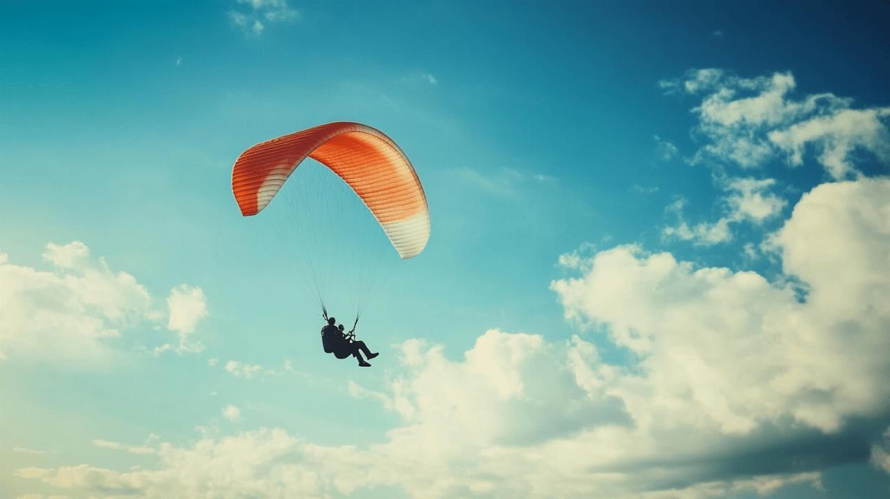
For those of us who take to the skies with nothing more than a canopy above our heads and the wind beneath our wings, understanding the behaviour of clouds is not merely academic. It is an essential skill that separates a safe and exhilarating flight from a potentially perilous one. Whether you are gliding above the volcanic peaks of the Puy de Dôme or soaring along the coastal winds at Dune du Pilat, the clouds above you tell a story. They reveal the invisible forces at work in the atmosphere and offer crucial clues about what lies ahead. Recognising these signs and knowing how to interpret them can make all the difference when you are aloft.
Cloud formation and classification: understanding what's happening above
The science behind cloud formation and atmospheric moisture
Clouds are born from a delicate dance between warmth, moisture, and the ever-changing pressures of the atmosphere. When warm air rises, it begins to expand and cool as it ascends. Cooler air cannot hold as much moisture as warmer air, so the water vapour within it reaches a point where it can no longer remain invisible. At this threshold, the vapour condenses around tiny particles suspended in the air, such as dust or salt crystals, forming the droplets or ice crystals that we see as clouds. This process is influenced by a host of factors including temperature gradients, humidity levels, and the presence of atmospheric pressure systems. For paragliders, this means that the conditions on the ground are intimately connected to what is happening overhead, and a keen awareness of these dynamics is vital for planning a successful flight.
Identifying cloud types every paraglider must recognise
The sky is a constantly shifting canvas, and each type of cloud carries its own message. Cumulus clouds, those fluffy white formations that dot the sky on a fair day, are often a welcome sight for pilots. They typically mark the presence of thermals, those rising columns of warm air that can lift a paraglider to impressive heights. However, it is important to remember that these benign-looking clouds can grow and develop into something far more menacing if conditions are right. Cumulonimbus clouds, the towering giants of the atmosphere, are the ones to watch with the greatest caution. These colossal formations can stretch upwards to altitudes exceeding twelve thousand metres and are capable of producing heavy rain, lightning, and violent winds. Encountering one of these behemoths is a situation every pilot must avoid at all costs, as the forces within them are immense and unforgiving. Stratus clouds, on the other hand, appear as flat, featureless sheets that can blanket the entire sky. They often signal stable atmospheric conditions, but their presence can also mean reduced visibility, which poses its own set of challenges. High above, cirrus clouds form delicate, wispy patterns made entirely of ice crystals. These high-altitude clouds often serve as harbingers of an approaching weather system, and their appearance should prompt a careful review of the forecast. In the middle layer of the atmosphere, altostratus and altocumulus clouds are composed of water droplets and can indicate a range of conditions from settled weather to the early stages of a front moving through. Stratocumulus clouds are lower down and can appear as a lumpy layer, while nimbostratus clouds are the grey, formless masses that bring prolonged rain. Each of these cloud types has its place in the atmospheric hierarchy, and being able to identify them quickly and accurately is a skill that every paraglider must cultivate.
Reading the Sky: Weather Forecasting and Flight Planning for Paragliders
Interpreting met office data and cloud base heights
Before any flight, a thorough examination of the weather forecast is not just advisable, it is absolutely essential. The Met Office provides a wealth of information that can help pilots make informed decisions about whether to fly and where to fly. Pay particular attention to the cloud cover predictions, the expected height of the cloud base, and any indications of cloud development throughout the day. Cloud base height is particularly important because it determines how much vertical space you have to work with. A low cloud base can limit your ability to gain altitude and may also reduce visibility, making navigation more difficult. Conversely, a high cloud base can offer more room for manoeuvre, but it can also mean that the air is less stable and more prone to the development of larger, more dangerous cloud formations. The forecast will also provide information about wind speeds and directions at various altitudes, which can have a significant impact on your flight path and the level of turbulence you might encounter. By cross-referencing the cloud predictions with the wind data, you can build a comprehensive picture of the conditions you are likely to face and plan your flight accordingly.
Recognising warning signs and assessing flight conditions
Even with the best forecast in hand, the sky itself remains the most reliable source of real-time information. As you prepare for your flight, take the time to observe the clouds and note any changes in their appearance or behaviour. Rapid cloud development, especially in mountainous regions, is a clear warning sign that conditions are becoming less stable. If you see cumulus clouds beginning to grow vertically and take on a more towering appearance, it is a signal that strong thermals are present and that the atmosphere is becoming more active. While this can be exciting for experienced pilots, it also increases the risk of encountering turbulence and, in the worst cases, being drawn into a cloud. The phenomenon known as cloud suck occurs when a pilot is inadvertently pulled upwards into a cloud by a powerful thermal, and this can lead to disorientation, icing, and a complete loss of visual reference. If you find yourself in a situation where the clouds are deepening beyond a safe threshold, or if you notice convergence lines where air masses are colliding, the best course of action is to retreat to clearer skies. It is always better to be on the ground wishing you were in the air than to be in the air wishing you were safely on the ground. Safety must always come first, and there is no shame in choosing not to fly when conditions are beyond your comfort level or experience.
Cloud Dynamics at Premier Flying Sites: Puy de Dôme and Dune du Pilat
Mountain Cloud Behaviour and Rapid Weather Changes at Puy de Dôme
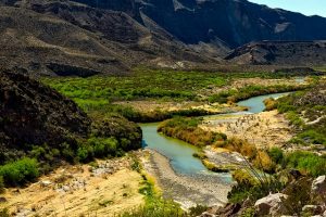
The Puy de Dôme, a volcanic peak in the heart of France, is a favoured destination for paragliders drawn to its dramatic landscapes and reliable thermals. However, the mountainous terrain also brings with it unique challenges when it comes to cloud behaviour. The topography can cause air to rise rapidly as it encounters the slopes, leading to the swift formation of clouds that can develop in a matter of minutes. This rapid cloud development is particularly common in the afternoons when the sun has had time to heat the ground and create strong thermals. Pilots flying in this area must remain vigilant and be prepared for sudden changes in the weather. A clear sky can quickly become overcast, and cumulus clouds can grow into cumulonimbus formations with little warning. The key to flying safely at Puy de Dôme is to maintain a constant awareness of the sky above and to be ready to adjust your plans at a moment's notice. If you see clouds building up and taking on a darker, more ominous appearance, it is time to consider landing or moving to a safer area. The mountains are beautiful, but they demand respect and caution from those who venture into their skies.
Coastal Cloud Patterns and Sea Breeze Effects at Dune du Pilat
In contrast to the mountainous environment of Puy de Dôme, the Dune du Pilat offers a completely different set of cloud dynamics shaped by its coastal location. As Europe's tallest sand dune, it provides a stunning launch point for flights over the Atlantic coast, but the proximity to the sea introduces weather patterns that are distinct from those found inland. Sea breezes are a common feature here, as the temperature difference between the land and the sea drives the movement of air. During the day, the land heats up more quickly than the water, causing the air above it to rise and draw in cooler air from the sea. This sea breeze can influence the formation and movement of clouds, often bringing in moisture that leads to the development of stratus or stratocumulus clouds along the coast. These clouds can affect visibility and the stability of the air, so it is important to monitor their progress and anticipate how they might impact your flight. The coastal environment also means that weather conditions can change more rapidly than they might further inland, as systems moving in from the ocean can bring sudden shifts in wind and cloud cover. Pilots flying at Dune du Pilat should always keep an eye on the horizon and be prepared for the possibility of an approaching front. The beauty of flying over the dunes and the sea is unmatched, but it requires a keen understanding of the local weather patterns and a readiness to adapt to changing conditions. By staying informed and remaining observant, you can enjoy the unique experience of coastal paragliding while keeping safety at the forefront of your mind.